

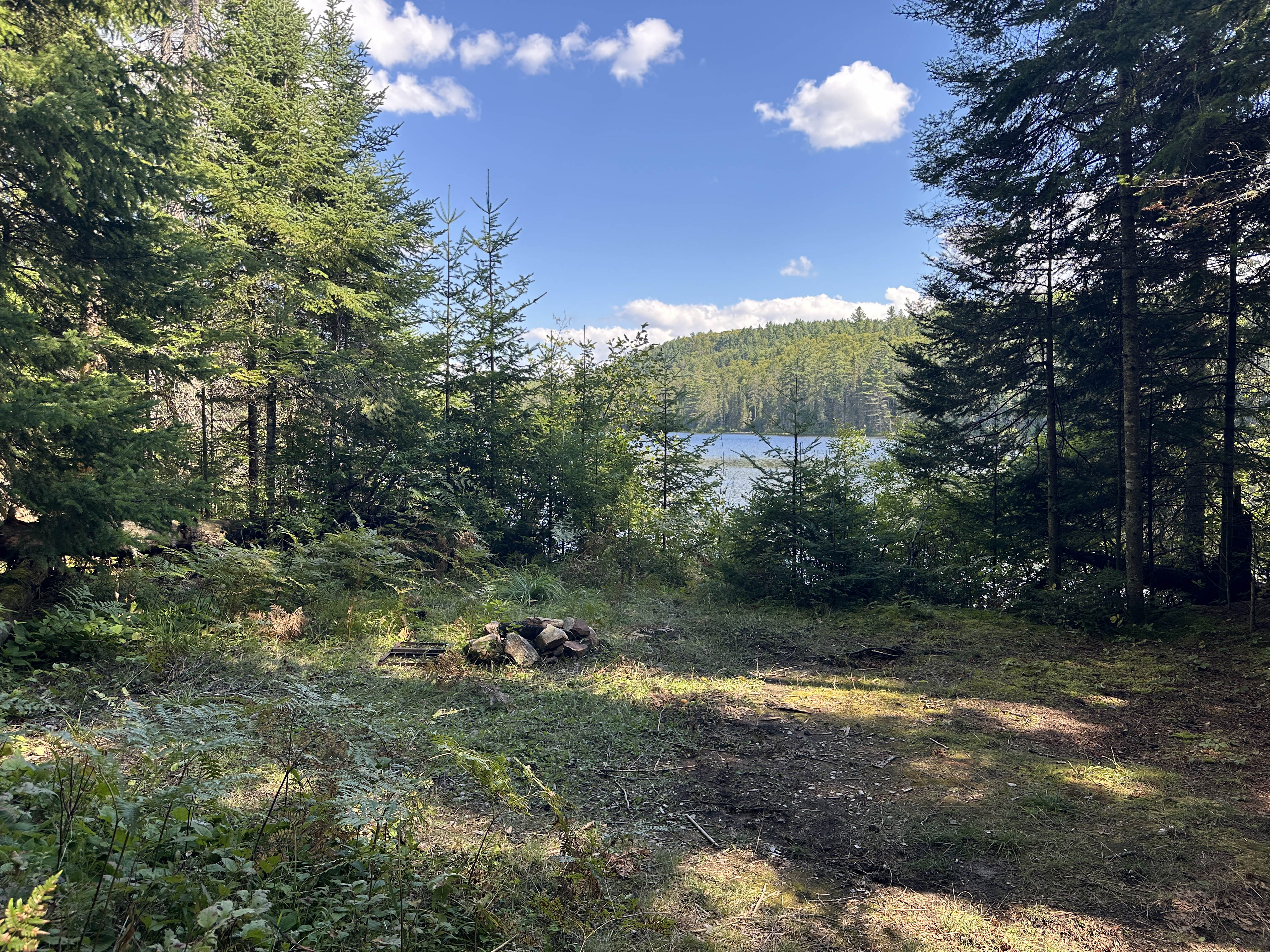
My daughter and I arrived at the Shall Lake access point mid afternoon. Being the start of September, this meant we still had a decent amount of daylight left to us, but not the seemingly infinite amount you get earlier in the summer. By my guess we had about 4.5-5 hours to get to Booth and be set up, and it was a trip that would take us 2 hours at most. This meant that we would have plenty of time to get set up before the sun decided to check out what was going on in Australia. I wouldn’t have wanted to be heading over to Godda or Ryegrass, but Booth wouldn’t be an issue. We stopped into the permit office to say hi and see if there were any updates or advisories for the area (“gonna be a lot of people tomorrow” was the main one) and then hit the water.

To get to Booth Lake from the access point you paddle through Farm and Kitty Lake, along with a couple of short sections of the Opeongo River. I’ve talked about this paddle in detail a few times (most recently in this year’s spring trip report) so I won’t go into it in depth here except to say that it’s a lovely stretch. You’re paddling upriver on the river sections, but the current isn’t killer except for one spot as you approach the p640 over to Booth where the fast moving water is going to do everything in its power to shove you into some nearby rocks. We were through Farm Lake and past the Kitty Lake Ranger cabin (still not located on Kitty Lake, despite its name) quickly, and over the first portage of the trip, the short p90 onto Kitty Lake, just as fast. We double carried the next portage (that p640 over to Booth) because once again I had packed according to Drew’s Law of Inverted Packing Efficiency which states that the shorter the trip, the more unnecessary gear has to be packed. However, my daughter is a pro at portaging, so it wasn’t too long before we had the boat loaded and ready to set out on Booth, even with some bonus portage appreciation time along the way.


Booth is where the fun began. As we passed the dark, empty hole in the shoreline that marks the entrance to site #2 I saw that the site was empty and let out a breath of relief that I didn’t realize I’d been holding. See, site #2 is the first site you see when you start paddling up Booth (site #1 no longer exists. I’m going to have to update my map at some point, but that point isn’t today) but the last site you’d pick. I know this for a fact, because a couple of years ago, after paddling around Booth and finding everything else taken, we ended up there. Seeing that it was empty this time around meant that Gordon and his group had found somewhere better. Now we just had to find them and that somewhere better.
We came out of the southeast bay and turned north. It was a windy day. Not “you shouldn’t be paddling in me” kind of wind but more “hi, I’m going to make this 25% more difficult for you” wind. Fortunately, the wind was at our backs as we made our way up along Booth’s eastern shore. Unfortunately, this just meant that we were being blown by site after site that had already been taken, and not by our group.

I mentioned earlier that there are two parts to Booth. The majority of the campsites are in Booth’s southern half, but there are two in the northeast corner, right by the Chipmunk portage. The problem with these sites, if you happen to be scouring the lake looking for friends, is that they’re a decent paddle away from everything else. That meant that if we got up there and found them both taken, we’d be dealing with a reasonably strong headwind all the way back down the lake. Which would suck. The good news is that I’d thought of this when I was packing (my absurd amount of gear) and threw in my (discount bin) binoculars. The bad news is that while the binoculars helped me confirm that the sites were taken, either they or my eyes weren’t sharp enough to determine if the sites were taken by our group. So I had a decision to make. Keep paddling north to potentially have to turn right back around, or roll the dice.

While it had been impossible to make out the features of the people I could see through the binoculars, it was easier to see the canoes pulled up on shore. None of the ones I could see matched the green of Gordon’s family’s canoe. So the dice were rolled. Squashing down the nagging voice that was reminding me that they could have very easily pulled their boat out my line of sight and left their second canoe (a rental) by the water instead, we turned our canoe around and paddled back into Booth’s southern basin.
The wind was stronger now. We were paddling into it head on and neither of us were loving it. Fortunately, we only had to deal with the wind for a short stretch before we could turn west and get into the shelter of a large island. There was only one campsite on this island, a nice looking spot facing the Ryegrass portage, but it was taken. By now it was getting later in the afternoon. The September sun was starting to fade and I was acutely aware that even when we found the site we’d still have at least an hour of set up and meal prep that would be much better done in the daylight. My daughter and I talked it over as we paddled away from that island site and decided that if we couldn’t find our group soon we’d head over to site 2 (shudder) and set up for the night.

Before we settled for the campsite equivalent of three day old pizza we had two more chances to find our group. The first would be a group of three sites in the vicinity of McCarthy Creek (out of Booth’s southwest corner) and the last would be a group of four sites scattered around Booth’s southern island.
As soon as we came out of the shelter of the Ryegrass island site we were able to write off the first three sites. All three looked deserted, without any visible boats or tents.
Ugh. One option down, one to – wait, who’s that?
As we came closer to the far shore, I realized that there was a person sitting on the rocks on one of the sites that had looked empty, blending into the background like they had been taking lessons from Peeta Mallark. She saw us at about the same time and started waving an orange towel. Realizing that we’d either found our friends or come across someone who really wanted to show off their towel, we turned our boat towards the site and started paddling (I don’t think it was actually a towel, maybe a wrap or a shawl or something? Whatever it was it was big and orange).

The good news was that it was our group on that site. The even better news was that the site was awesome (click here for the full site report). It was a big, open space with plenty of room for tents, a good kitchen set up, decent swimming and a massive cliff face next door (that has a great view from the top). Tucked about halfway down a bay on Booth’s south shore, it was also very private. There were no sites past us and no portages out of the bay, which meant no reason to paddle past unless you wanted to watch me struggling to remember how to set up my aerial tent. Space, privacy and views on Booth Lake on a Labour Day long weekend? I wouldn’t have believed it was possible if I hadn’t seen it myself.
We spent the rest of the evening getting set up and catching up with the others. They’d paddled the same route we had*, so you’d think we wouldn’t have much to tell each other about the trip in, but you’d only think that if you didn’t know about The Party Boys.

I said it was a decent sleep that first night, which is true, but I can’t call it a sound sleep. I woke up a few times, usually when the wind picked up. I’d hear the trees creaking, feel the Aerial shift (but not too much), and spend a couple of half asleep minutes holding my breath and wondering just how far I’d get flung if one of the trees holding up my tent decided to call it quits. Fortunately, while the wind stayed strong through most of the night, the trees holding up my tent stayed stronger and by the time I woke up the next morning the rain had blown itself out and my tent hadn’t been turned into a slingshot.
While my tent may not have been turned into a slingshot, the gear hammock directly below my tent had been turned into a pool. See, the wind had been so strong overnight that the rain had come in on enough of an angle that it managed to limbo under the fly and provide me with a whole lot of well rinsed camping gear by sunrise (fortunately I always keep my clothing personal in the tent with me, so everything I was going to wear had stayed dry). The good news was that the rain seemed to be very much an overnight visitor, and it was shaping up to be a beautiful morning. I strung up a clothesline, hung pretty much everything I owned in the sun, and set about getting ready for the day.

Our plan for the day was to do a day trip loop out of Booth through some of the smaller, lower maintenance lakes just to the west of us: Ryegrass, Rumley, Godda and Mole (is that a series of lakes in Algonquin or a British law firm? You decide!). I was excited about the route. I hadn’t seen any of those lakes before and given how the year’s paddling had been going, there was a very strong possibility that this would be my last set of new lakes for the season.

We left the site mid morning, the eight of us split between two boats with enough portage snacks to last us to the Bonfield-Dickson and back. It was a short paddle across to the first portage of the day, a pleasant p380 over to Ryegrass Lake. The older girls wanted to try carrying the boats and my personal motto is “If someone else is offering to carry the damn thing, it’s theirs. Forever”. Both girls did awesome and Gordon’s daughter nailed her first official Algonquin portage as a canoe carrier. For context, when I was these kids’ age if I’d tried to carry a canoe across a parking lot, let alone across a portage, I would have ended up curled up in the fetal position underneath the smoking remains of the canoe (I don’t know how the boat would have caught fire, I just know it would have).


Ryegrass is a tiny little thing. More a pond than a lake, but still quite pretty! Once again kids took the lead in getting us across. My daughter paddled stern for our boat and Gordon’s son took the stern for theirs. They both did a great job getting us to the next carry, navigating the open water crossing and the narrow channel through the (I assume Rye)grass that leads into the next portage. Again, for context, if you’d put me in the back of a canoe when I was their ages and told me to get across the lake, I’d still be paddling in circles today.

The portage over to Rumley Lake (a p590) was a bit longer than the Ryegrass carry but not particularly difficult. There was some uphill towards the end, but I don’t remember it being overly challenging. That said, there is a steep-ish downhill right before Rumley. Not a problem going in our direction, but it wouldn’t be an ideal way to start the portage going the other way.

We stopped on Rumley to check out its lone campsite. Fun fact: this site does not exist in the online reservation system. This means that you can’t get a permit for it, which is too bad because it’s a lovely little site (emphasis on little). I wouldn’t want to be there with a big group, but it’s a nice little spot on a nice little lake if you’re solo or with one other person. The massive tree down across the middle of the site is a bit of a hurdle, but otherwise it’s got a good fire pit area, decent swimming and good views.
Apart from the campsite there isn’t much that stood out about Rumley. It’s a pretty lake, but like Ryegrass it’s not one that’s going to take a lot of time to get across. You know what does take some time to get across? The next portage, a p1380 over to Godda Lake.

This portage was messy. Not “I can’t find the path” messy but more “I found the path, and so did all of last night’s rain” messy. There was a constant supply of mud and muck along the way, along with a couple of strategically placed quagmires of standing water and slippery rock. The real treat, however, was towards the end of the carry. Here the path crosses a small creek on a bridge of three slippery logs in various stages of decay. Gordon and I had the boats and were the first to arrive at the crossing. I went first and made it across despite a couple of steps where the log and I disagreed on where my foot should go. Gordon came about 20 seconds after. By this point I was back on the path and just out of sight so I heard rather than saw Gordon lose his own argument with the logs and end up in the creek with an resounding splash.

Here’s the thing. Falling with a canoe on your head is not a joke. Falling into a pool of mucky water that could be hiding old stumps or sharp rocks or God knows what else with a canoe on your head is even less funny. I called out to Gordon to see if he was okay and went through what felt like a lifetime’s worth of mounting panic when it took him a couple of seconds to respond. I was halfway to convincing myself that he’d broken a leg or worse when he called back that he was fine. As he put it “I wanted to make sure I actually was fine before I said I was”, which makes all the sense in the world. We finished off the portage (to add insult to injury this is one of those carries that makes you think you’re at the end before turning and following the shoreline for another 100 meters), then went back to help the rest get across. Thankfully, Gordon was the only one of the group who ended up taking an impromptu bath, and we ended up on Godda more or less in one piece.


After about an hour of taking it easy we packed up for the trip back to Booth. We only had one more portage in front of us, the P730 back to Mole Lake, and after a bit of uphill to get things started I remember this being a pleasant, mostly downhill carry. I also remember being thoroughly unimpressed by the campsite waiting at the other end of this portage.

Mole Lake has two sites on it. One is located at the start of the portage over to Godda, the other is located across the water at the start of the portage over to Raja Lake. I’m going to save you some time. If you have to stay on Mole Lake (and I’m not sure that this is a thing you’d want to do in the first place), take the Raja portage site. It’s not spectacular, but it’s got room for a couple of tents, a good fire pit area and nice views. The Godda portage site, on the other hand, is a small, enclosed, frankly somewhat depressing, hole in the forest a few short steps from the portage. There’s no signage that’s visible from the water. Instead, the campsite sign is tacked to a tree at the start of the (very short) path over to the Thunderbox. In other words, the campsite is so unimpressive that even its sign is trying to disassociate itself from it. On the plus side, easy access to the portage up to Godda, so that’s a win I guess?
With that paragraph, I’ve spent more time talking about the sites on Mole Lake than it took us to paddle across it. But you know what took plenty of time? Getting around the deceptively short looking liftover from Mole to McCarthy Creek. Let’s reminisce.

Coming out of Mole Lake you’re greeted with what looks like a pretty standard liftover. There’s a large, sun-bleached log splayed across the creek and then, about five meters later, another large, sun-bleached log that’s decided to join the party. From the water, this looked to me like the best (and only) option. We pulled up to the first set of logs and the four in our boat (me, Gordon, our two daughters) climbed out to try and plan our attack. We settled on “drag the boats over the logs, but let’s not put any holes in the bottom while we do it”, so some pretty strategic thinking if you ask me. I should mention that we were doing this strategizing while also channeling our inner tightrope walkers. The logs were wide enough that I was confident that people would be able to keep their balance while we shifted the boats, but narrow enough that a small but insistent voice in the back of my head was whispering “you sure about that?”

Gordon and I manhandled our boat up and over the logs and into the no-man’s land between the two obstructions. At around the same time my daughter noticed a grass choked continuation of the creek off to the side. We debated if this was a viable workaround while we got the second boat over the logs, then settled that debate pretty thoroughly when another group came up the creek from the direction of Booth and used the path as a workaround.

By this point we were committed to the log hurdle approach. TBH, I don’t know which would be the better way to go. The log hurdle has a higher potential for an unplanned dip, but if done efficiently would be faster. It would likely stay my first choice for day paddles or trips where I was packing light. It might get dicier if I was loading and unloading a full canoe each time; in that case I’d probably consider the path through the grass which was, essentially, a 20 meter drag. I dunno. Neither were awesome. What I do know is that for some reason this junction was the happening place to be that afternoon, as we ran into (I think) three separate groups all converging on the spot at the same time, after seeing only one other group the entire rest of the day.
Once we were over the second set of logs we settled in for the long(ish) paddle out to Booth. To get from Booth to Mole you paddle along McCarthy Creek, a winding, slowly widening, squiggle through the lily pads. I’d been wondering what the water levels would be like along McCarthy as my basic expectation for anything with the word “Creek” in its name is that at some point I’m going to be ripping what’s left of my hair out while screaming about beavers, but they were fine. There were a couple of dam(n beavers)s and shallow-ish spots, but other than those it was smooth paddling.
 The scenery along the creek was quite pretty. It starts off as a narrow ribbon of water twisting between banks of tall grass, then gradually widens out until that narrow ribbon becomes a sheet and those banks of tall grass become lily pads. The route passes a couple of nice rock formations (I’m a sucker for nice rock formations) and is, in general, a really pleasant paddle.


 We arrived back on our site somewhere between 4:30 and 5:00 pm. Not long after, the kids, Jess and I climbed to the top of the nearby cliff. I wouldn’t recommend this if you’ve got younger children or a particularly suicidal dog, but the view from up there was great. The best lookout is only about a four-minute hike from the site. It’s a bare rock ledge surrounded by pine boughs that overlooks the bay and, further on, Booth’s west side.

The rest of the day passed in a kind of golden blur. Unlike the night before, there wasn’t a hint of rain in the sky and the site’s exposure ensured we had decent light until the sun dipped below the trees. Gordon’s family had brought a bocce ball set (because who doesn’t love portaging bocce balls?) and it was the MVP of the evening. We rounded out the night with some marshmallows by the campfire while Gordon and I planned the route for our upcoming annual fall trip (which, sigh, did not happen thanks to a last-minute change of plans with some foundation work at my place. First time in seven years there hasn’t been some iteration of that trip going out in September). I eventually retreated to my (now level!) tent for a quick check-in with Middle Earth before falling asleep to the sound of the older girls giggling and, crucially, absolutely no rain soaking all my gear beneath me. All in all, it was a good end to a great day.


This was another great family trip out of the Shall Lake access point. I’ve always thought of Booth Lake as a good family destination, and that just gets reinforced every time I go there or paddle through. It’s enough of a trek that everyone feels like they’ve accomplished something, but not too far that you’d feel like you couldn’t get out if you needed to or like you won’t get there before the meltdowns start. To be clear, I just said you’ll feel like you’ll be able to get there before the meltdowns start. Reality doesn’t care about your feelings and meltdowns can start before you even get the canoe off the roof of your vehicle. Still, if there’s going to be a meltdown, the stretch up to Booth is as good a place to have one as anywhere else.

The only thing I’d change about this trip was in the pre-planning. While Gordon and I had a strategy to meet up on Booth, we could have fleshed it out a bit better. Picking a route around the lake that we’d both follow was a good idea, but the route I suggested was not. Instead of starting with the eastern shore, which has been full every time I’ve been to Booth, we should have started with the southern island, then made our way clockwise around Booth. This would have gotten us to the less in demand sites first. On top of that, because of the way Booth is laid out, we still would have had visibility onto the eastern shoreline sites as we paddled around. The two sites at the top of Booth (sites 9 and 10) should have been our last resorts.

The other thing we should have thought more about was a signal system from the campsite. I’d given Gordon my InReach to message me once they picked a site. Texts from an InReach include a GPS track that is plotted against a map. In other words, if you want someone to find you it’s the next best thing to the Bat Signal. However, that option goes from pretty good to useless if the person you’re texting doesn’t receive the message. Turns out I was closer behind them than I thought I’d be, and by the time they were on a site I was already out of cell range. No cell service, no Bat Signal. Without any idea of where they’d ended up, I was looking for Gordon’s distinctive green canoe as we paddled around. This makes sense, canoes are easier to see than people. However, I didn’t tell Gordon that was my backup plan. And, unfortunately, a backup plan is only useful if everyone is in on it. Fortunately, they also thought of a signal and were ready with that orange towel (wrap? shawl?). Still, it would have removed a whole lot of uncertainty if we’d set something up ahead of time.
Those two nitpicks aside, there’s nothing I’d change about this trip. These family trips are always a ton of fun, and I got to check out a few new lakes as an added bonus. I’m loving watching the kids grow and challenge themselves a bit more with each year. I have no doubt that next year the two older girls will be carrying the boats on even longer portages, and we’re fast approaching the point where my main job will be to sit in the middle of the canoe and eat the portage candy while the kids ferry me around.
Can’t wait.


It was an orange sarong!